Feeding South Florida Access Map
- Python
- PostgreSQL
- MapLibre GL
The problem
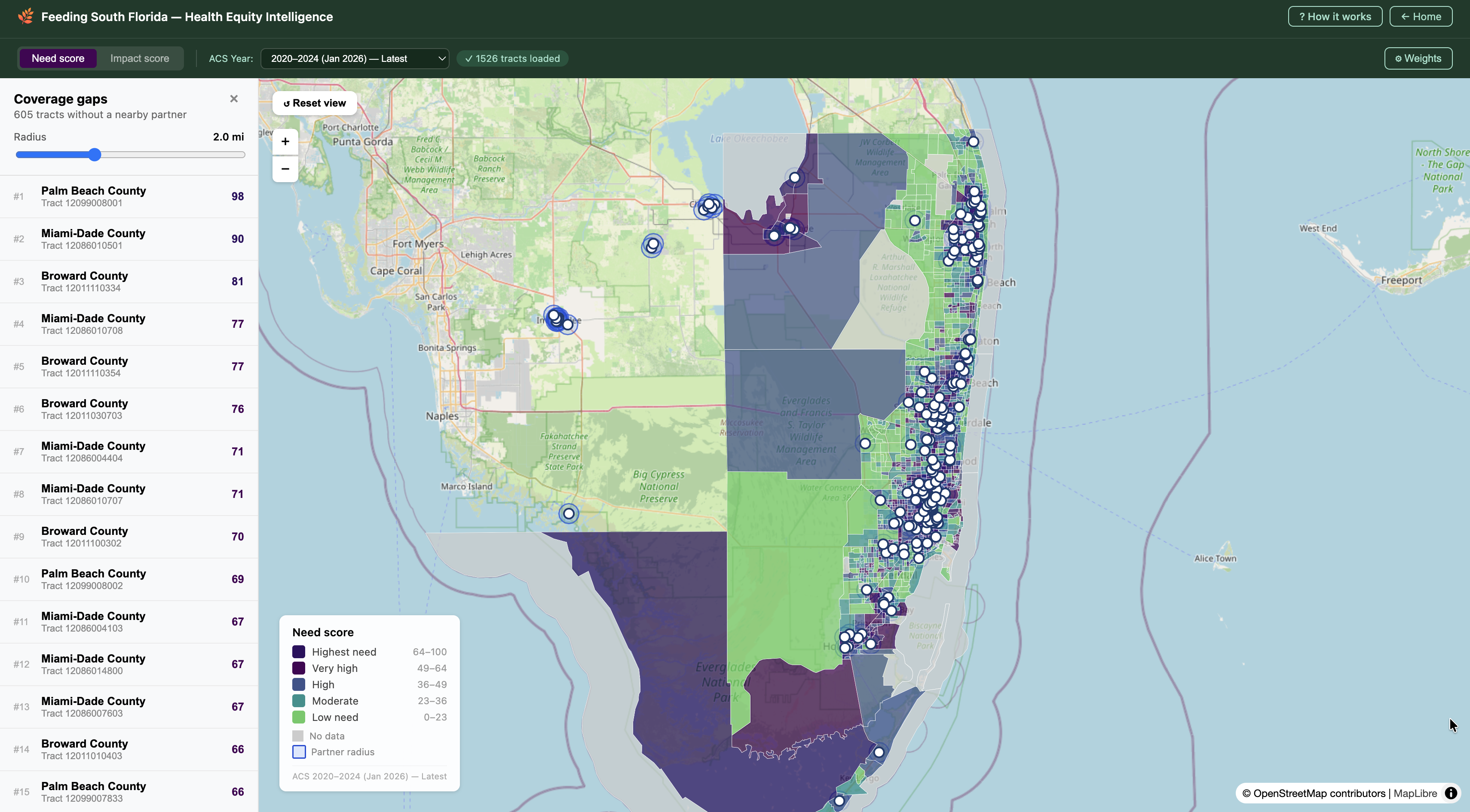
Feeding South Florida partners with more than 150 locations across the four counties it serves: churches, community centers, and more. Spread across 1,497 census tracts, it's genuinely hard to tell just by looking at a list where support is falling short. A map built on real Census and USDA data is the tool that actually shows where the gaps are.
My involvement
I worked on this through ITWomen, a nonprofit focused on closing the gender gap in tech, which paired a group of us college students directly with Feeding South Florida. Each person on the team took on a different challenge, so together we built a whole range of tools for FSF, not just the one I worked on.
My role
My piece was the access map itself. I built a Python pipeline and geospatial algorithm that ranks each tract on seven Census and USDA food-access indicators, and shipped it as a full-stack platform FSF staff could explore directly to guide outreach.
What's next
This partnership is still going. I'm constantly taking FSF's feedback because I want this tool to actually work for the people using it, not just look good in a demo. Our team will be presenting our solutions soon at the ITWomen AI for Good challenge.